| Distance | 6.41 mi |
| Elevation Gain | 1453 feet |
| My Time | 3 hr 15 min |
| Difficulty | Moderate |
| Nearest Town | Georgetown |
| Food Nearby | Whistle Stop |
Silver Dollar Lake
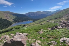
I tried out the Silver Dollar Lake trail after my neighbor told me that it was an easy hike with great views. Part of that is true and Kyle won’t be borrowing flour anytime soon after underselling the difficulty a bit. I think the views towards the top of are some of the best I have seen since I started hiking again and you actually get to see 3 alpine lakes with access to 2 of them. It really is a nice ending but getting there sure is a challenge for a relatively short trail.
The Beginning
There are a few parking area for the Silver Dollar Lake Trailhead. Off of Guanella pass there is a small turnoff to Naylor Lake Road. Naylor Lake Road is steep and rutted and there were potholes I could curl up in and take a nap.
I wasn’t about to try that with my car so I took a spot in the parking lot across the street from the turnoff. That just meant that I had to walk up the road to get to the trail head. It is just about a half mile to make it up the road and it is steepish. You will gain about 200 feet of elevation. There are some pull-offs for cars which have some nice views if you need a little break. One of the pull-offs I saw a woodpecker beating a tree and on other one I saw this runoff stream which was really nice.
The pull-offs seem to be available for day trips but overnight camping is not allowed. After the half mile you will come to another small parking area and the trailhead will be on the left. Oh goody, you can start your hike after already starting your hike!
The Second Beginning
You have made it to the trail head and can start the hike! This is actually a pretty nice section. It is covered with trees and there are some roots and some rocks on the trail but mostly the trail itself is in pretty good condition here. It is still relatively steep. You will walk through the woods for about another mile, and another 350 or so feet in elevation, until you come to an area where you can drift off to the right to get your first view of Naylor lake. There may have been a trail spur to get to the lake but I didn’t see it so for my purposes Naylor lake is just for pictures. It is a pretty cool lake though.

After the lake area you lose almost all cover for the rest of the hike. You will be exposed so make sure you sunscreen up.
On the way to Silver Dollar Lake
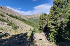
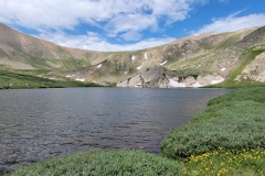
As the trail exits the shade of the forest the trail itself gets more difficult. It becomes much rockier and at points gets a little ledgy with not much between you and a hefty slide down the mountain. This is the longest stretch of the trail as you will go about a mile and half and gain 500 feet of elevation. The going can get a little slow as you navigate the rocky surface. In early July, I also encountered 2 patches of snow to cross and a couple of small sections that were muddy. There are more short bursts of elevation and longer flatter sections here so it isn’t too bad once you get through the short bursts. Silver Dollar lake is pretty amazing and well worth the walk.
There are some nice places to rest at the lake as well. I took advantage of a break to grab some beef jerky as the trail to Murray lake is steep and lingering over you. You will have to cross the small runoff in the video above to make it to the last lake.
Murray Reservoir
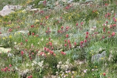
The hike from Silver Dollar to Murray Reservoir is the steepest you will encounter. In 3 tenths of a mile you will climb 300 feet in elevation before descending back down to Murray a bit. Since I’m fat, I needed to stop several times but the hill is covered in wildflowers to one side and spectacular views of the two lakes you passed on the other side.


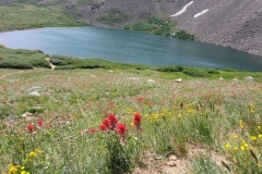
Once you get to the top of the hill you can see Murray reservoir. It is tucked up against a mountain and is crystal clear. Some dogs that made the trip with others jumped in and took a swim and an unnamed person may have accidentally stepped on a too shallow rock and I can tell you that water was cold. This is a really nice place to relax as there is a decent amount of shoreline that is accessible. Murray lake has a bit of a runoff as well and I got this video from the bank and it almost looks like an infinity lake.
As always there are many more pictures in the gallery below but first here are some stats from today’s hike.
Time Lapse of the Silver Dollar Lake Hike
I have put together a time lapse video of the hike to give you a feel of what it will be like. I like to call these the Hikers Edit. If you enjoy the video, please subscribe to my YouTube Channel. It is free to subscribe and you will get all of the latest content!
Elevation and Distance
My stats are going to be a little more than some of you. I don’t have a car to make the upper lot so I hiked from the bottom.
If you don’t have the AllTrails app you might want to check it out, I really love mine. It records your progress and is a great way to search for hikes that are nearby and gives you difficulty measurements. According to AllTrails today’s hike was around 6.41 miles and had a total elevation gain of about 1453 feet including undulations. That put the high point at around 12,215 feet at Silver Dollar Lake. I was also moving for a total of 3 hours and 15 minutes.
I am a Pro member of AllTrails and love it. If you are interested in the platform, please consider using my affiliate link for AllTrails. It gives me a small commission with no extra cost to you.
Effort
This was a good little hike. There is a decent amount of elevation for a relatively short distance. I don’t think I could recreate these step stats to hit exactly 14,000 if I tried though. Here are today’s stats from Fitbit.

Terrain
All of the above in the terrain department. There are sections of dirt road if you parked where I did, sections of forest, sections walking over rocks, and sections with mud and snow. Oh and if you want to get up to Silver Dollar Lake from Murray lake you will have to cross a stream over rocks as well. I strongly recommend hiking shoes for this hike.
Access
The trail head is up a very rutted and pot-holed (some about 2 feet deep) steep road, Naylor lake road, when you turn off of Guanella pass. There is a small lower parking lot before the road and bit of a larger parking lot across the street. The upper parking lot will need a car with decent clearance to access it. There is room for about a dozen cars in the upper lot. It was filled up at 7:45 on a Friday morning when I went.
Wrap up
I will be honest I totally underestimated this hike. It is a shorter hike, especially to get to some alpine lakes, at around 6 miles round trip and I just didn’t take it seriously enough. I learned my lesson fast enough though.
The hike is challenging in that there are sections of elevations, sections of stepping over rocky terrain, back to elevation, now snow, how bout some mud, and finish off with some more elevation. The views throughout the hike are well worth the effort it will take to get there. These are honestly some of the best views I have seen since I began this blog.
There were also a ton of people on this hike and they were all very nice. Shout out to the ladies from Nebraska and Bill and his crew for some good laughs. With the exposure and the crowding I would suggest getting there nice and early if possible. If you have the time this is a really nice hike.
After the hike I went to the Whistle Stop Cafe in Georgetown for lunch, they might be worth a try if you are looking for breakfast or lunch.
Reminder that this hike and all of the hikes that I have reviewed are on my interactive map and coded by difficulty according to me. You can find the map page here. If you have suggestions for a hike you want me to try you can email me at fatmanlittletrails@gmail.com. You can also connect with me on these social media platforms:




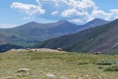



Cool pictures of the moon over the mountain, and can’t believe how much snow is still up there for July.
Silver dollar is one of my favorites…you’re right about the hike up the road to even begin the hike… I love my Jeep 🙂
Great photos!
Pingback: Whistle Stop Cafe - Georgetown - Fat Man Little Trail
Pingback: Outstanding Blogger Award Nomination – Interview With an Adventurer - Fat Man Little Trail