
| Distance | 10.17 mi |
| Elevation Gain | 860 ft |
| My Time | 3 hr 34 min |
| Difficulty | Moderate |
| Closest Town | Pine |
| Food Nearby | Buck Snort |
Chair Rocks
Chair Rocks is a long but less challenging trail that has some good views but spends most of the time in a burn scar so make sure you are prepared for the elements.
Starting out
Finding the trail can be a bit of a challenge as it is just a small pull-off that is unmarked on Deckers Road near the Buffalo Creek area. From there you will cross the road and see a small marker for the Colorado Trail.
The trail keeps you pretty close to the road at the beginning as you are up against private property. This will last for about a half mile until you will get your first view of the burn scar that you will spend most of your time walking through.

The Burn Scar
There is something intrinsically beautiful about a burn scar. Plants sprouting out of the ash and decay of the fallen forest has a nice symmetry to it. That being said, this is a long time in the burn scar.
The burn scar is going to be with you for the next 3.5 miles or about 60-70% of the hike. You will be completely exposed with little to no cover. I picked a cloudy fall day and it was a comfortable walk but make sure you are prepared if you take this walk in the summer months.
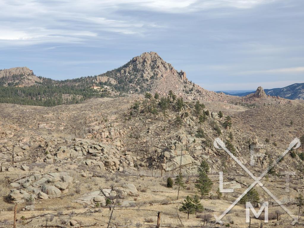
The scar does leave a lot of unobstructed views of the surrounding land and rock formations which is nice so it isn’t all that bad. I do know some people who really like the scars but this was a bit much for me today.


Pine Forest and Logging Camp
When you finally make it out of the burn scar you will find yourself in a small and thin pine forest. The forest is a nice change and provides some cover. The trail starts to pick up a little bit of elevation gain at this point as well.
I was lucky enough to see this little family of deer about halfway through the pine forest.


The pine forest last for just under a mile and you will begin to see signs for the logging operation. This is where it gets a bit odd. The Colorado trail will split off and you will want to stay to the left and actually walk through the logging camp.
I thought it was strange but the trail continues past stacks off trees piled high and some dirt logging roads and continues on towards the Chair Rocks. There was nobody working at the camp while I was there which made me feel safe but not sure what I would have done if there were crews there.

Chair Rocks
As you pass through the logging camp you get your first real look at the chair rocks. They rise impressively above the trees and are more unique looking than the surrounding rock formations.

The trail will cut through the rest of the ground between the camp and the rocks and take you right to the base of the rocks. They are very impressive to look at up close.
There are some trails that led up onto some of the rocks and I am guessing that some people used that to climb around but that isn’t my game. I just got to the base and enjoyed them from there. There are also some great views of the surrounding Cathedral spire area from the rocks.


Distance and Elevation
If you don’t have the AllTrails app you might want to check it out, I really love mine. It records your progress and is a great way to search for hikes that are nearby and gives you difficulty measurements. According to AllTrails today’s hike was around 10.17 miles and had a total elevation gain of over 860 feet including undulations. The high point was actually in the parking area at 7,877 feet. I was also moving for a total of 3 hours and 34 minutes.
I am a Pro member of AllTrails and love it. If you are interested in the platform, please consider using my affiliate link for AllTrails. It gives me a small commission with no extra cost to you.
Effort
This was more of a long walk than anything exceptionally challenging. Most of the elevation gain is at the end of the hike and most of the first 3/4 of the hike are gentle hills through the burn scar. Here is my step count from my Fitbit.

Terrain
This is a well defined though narrow trail. It is pretty much a single file hike but the trail is mostly dirt and small pebbles. There is an occasional embedded large rock but nothing to hard to deal with. The most challenging aspect is that the trail is mostly through burn scar with no cover at all so you will be exposed to the elements. I went in mid November and it was nice and cool but I have been in this area in the summer and it gets really hot with no cover.
Access
There isn’t really much of a parking area for this trail. There is a small pull-off on Deckers Road (126) just past the village of Buffalo Creek with room for maybe 3 or 4 cars across the street from the marker for the Colorado Trail. No restroom facilities are available at the trailhead.
Wrap up
This was a nice long very low key hike. There isn’t a ton of elevation gain to challenge you but the distance makes it some good exercise. I did it on a cooler day which I think made it a little more enjoyable as you are exposed the entire time because of the burn scar.
While the scar does get a bit monotonous, the views of the surrounding area are nice. There is a beauty to the scar itself but I was really happy to get into some forest towards the end of the hike. Overall an enjoyable hike with nice big and unobstructed views of the surrounding area.
I have added this hike and all of the hikes I have done on my interactive map section you can find here. If you have a suggestion for a hike or any comments feel free to email me at fatmanlittletrails@gmail.com or you can follow me on any of the below social media platforms. Happy Hiking!


Pingback: Bucksnort Saloon - Pine - Fat Man Little Trail